
Taoyuan County topographic map
Interactive map
Click on the map to display elevation.
About this map
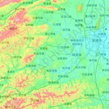
Name: Taoyuan County topographic map, elevation, terrain.
Location: Taoyuan County, Changde, Hunan, 415700, China (28.40850 110.84704 29.40186 111.61092)
Average elevation: 229 m
Minimum elevation: 24 m
Maximum elevation: 1,209 m