
Sosnowiec topographic map
Interactive map
Click on the map to display elevation.
About this map
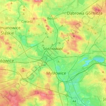
Name: Sosnowiec topographic map, elevation, terrain.
Average elevation: 272 m
Minimum elevation: 225 m
Maximum elevation: 347 m
For Sosnowiec's 100th birthday, the downtown area was thoroughly rebuilt, to harmonise its architectural layout and give the city a more modern image. In 2004 Sosnowiec authorities and designers were awarded the Grand Prix for the rebuilding of the downtown area in a competition for the best public space in the Śląskie Provinces. This investment had been accompanied by a program designed to improve the esthetic qualities of the city, under which a comprehensive program for unifying the colors of the elevations, and advertisements entitled “rainbow city” were introduced. Among the city districts there are:
Other topographic maps
Click on a map to view its topography, its elevation and its terrain.
Milowice
Poland > Silesian Voivodeship > Sosnowiec
Milowice, Sosnowiec, GZM, Silesian Voivodeship, 41-203, Poland
Average elevation: 261 m