
Russell topographic map
Interactive map
Click on the map to display elevation.
About this map
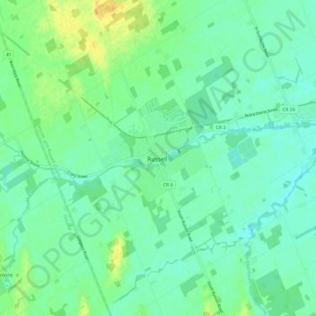
Name: Russell topographic map, elevation, terrain.
Average elevation: 74 m
Minimum elevation: 65 m
Maximum elevation: 91 m
Other topographic maps
Click on a map to view its topography, its elevation and its terrain.
Castor River
Castor River, Russell, Prescott and Russell Counties, Eastern Ontario, Ontario, K4R 1A6, Canada
Average elevation: 72 m