Geolocate

Vermilion topographic map

Interactive map

Click on the map to display elevation.

About this map

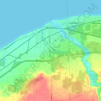
Name: Vermilion topographic map, elevation, terrain.

Location: Vermilion, Erie County, Ohio, United States (41.37968 -82.37871 41.43080 -82.28238)

Average elevation: 192 m

Minimum elevation: 172 m

Maximum elevation: 236 m

Other topographic maps

Click on a map to view its topography, its elevation and its terrain.

Sandusky

United States > Ohio > Erie County

Sandusky, Erie County, Ohio, 44870, United States

Average elevation: 177 m

Kelleys Island

United States > Ohio > Erie County

Kelleys Island, Erie County, Ohio, 43438, United States

Average elevation: 175 m

Sandusky

United States > Ohio > Erie County > Sandusky > Sandusky

Sandusky, Erie County, Ohio, 44870, United States

Average elevation: 184 m