
Terre-de-Haut topographic map
Interactive map
Click on the map to display elevation.
About this map
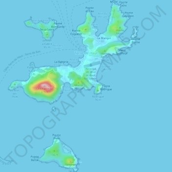
Name: Terre-de-Haut topographic map, elevation, terrain.
Location: Terre-de-Haut, Basse-Terre, Guadeloupe, 97137, France (15.83201 -61.60669 15.88407 -61.56581)
Average elevation: 8 m
Minimum elevation: -1 m
Maximum elevation: 278 m