
Eagle Lake topographic map
Interactive map
Click on the map to display elevation.
About this map
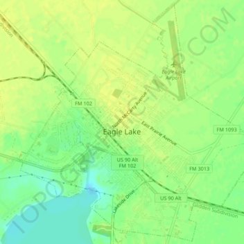
Name: Eagle Lake topographic map, elevation, terrain.
Location: Eagle Lake, Colorado County, Texas, 77434, United States (29.57335 -96.34878 29.60851 -96.30746)
Average elevation: 54 m
Minimum elevation: 42 m
Maximum elevation: 61 m
Other topographic maps
Click on a map to view its topography, its elevation and its terrain.