
Campbell County topographic map
Interactive map
Click on the map to display elevation.
About this map
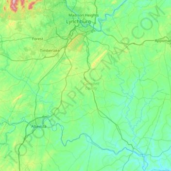
Name: Campbell County topographic map, elevation, terrain.
Location: Campbell County, Virginia, United States of America (37.02207 -79.44093 37.43542 -78.82604)
Average elevation: 219 m
Minimum elevation: 106 m
Maximum elevation: 809 m
Other topographic maps
Click on a map to view its topography, its elevation and its terrain.