
Oborniki County topographic map
Interactive map
Click on the map to display elevation.
About this map
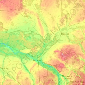
Name: Oborniki County topographic map, elevation, terrain.
Location: Oborniki County, Greater Poland Voivodeship, Poland (52.54455 16.57631 52.88883 17.13257)
Average elevation: 79 m
Minimum elevation: 40 m
Maximum elevation: 131 m
Other topographic maps
Click on a map to view its topography, its elevation and its terrain.