
Kirovsky District topographic map
Interactive map
Click on the map to display elevation.
About this map
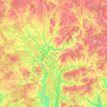
Name: Kirovsky District topographic map, elevation, terrain.
Average elevation: 216 m
Minimum elevation: 165 m
Maximum elevation: 263 m
Other topographic maps
Click on a map to view its topography, its elevation and its terrain.
Образцовка
Russia > Kaluga Oblast > сельское поселение Село Буднянский > Образцовка
Average elevation: 242 m