
Flüelapass topographic map
Interactive map
Click on the map to display elevation.
About this map
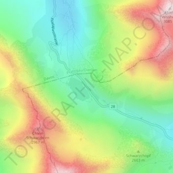
Name: Flüelapass topographic map, elevation, terrain.
Average elevation: 2,568 m
Minimum elevation: 2,225 m
Maximum elevation: 3,064 m
Other topographic maps
Click on a map to view its topography, its elevation and its terrain.
Swiss National Park
Switzerland > Grisons > Zernez
Swiss National Park, 28, Punt la Drossa, Zernez, Region Engiadina Bassa/Val Müstair, Grisons, 7530, Switzerland
Average elevation: 2,283 m