
Tabán topographic map
Interactive map
Click on the map to display elevation.
About this map
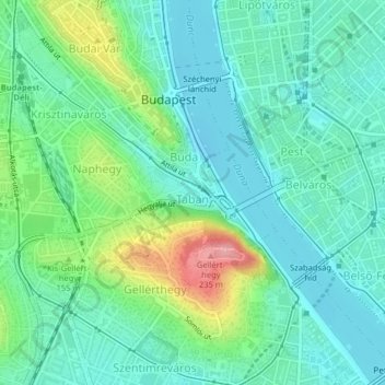
Name: Tabán topographic map, elevation, terrain.
Location: Tabán, 1st district, Budapest, Central Hungary, Hungary (47.48710 19.03588 47.49558 19.05131)
Average elevation: 130 m
Minimum elevation: 97 m
Maximum elevation: 225 m
Other topographic maps
Click on a map to view its topography, its elevation and its terrain.