
Gray topographic map
Interactive map
Click on the map to display elevation.
About this map
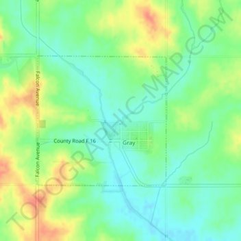
Name: Gray topographic map, elevation, terrain.
Location: Gray, Audubon County, Iowa, 50110, United States of America (41.83443 -94.99561 41.84900 -94.97618)
Average elevation: 426 m
Minimum elevation: 407 m
Maximum elevation: 453 m