
Giżycko County topographic map
Interactive map
Click on the map to display elevation.
About this map
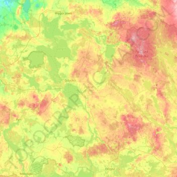
Name: Giżycko County topographic map, elevation, terrain.
Location: Giżycko County, Warmian-Masurian Voivodeship, Poland (53.85478 21.43336 54.18155 22.21416)
Average elevation: 134 m
Minimum elevation: 67 m
Maximum elevation: 226 m
Other topographic maps
Click on a map to view its topography, its elevation and its terrain.