
Saint-Sulpice-de-Favières topographic map
Interactive map
Click on the map to display elevation.
About this map
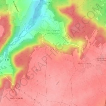
Name: Saint-Sulpice-de-Favières topographic map, elevation, terrain.
Average elevation: 130 m
Minimum elevation: 62 m
Maximum elevation: 158 m
Other topographic maps
Click on a map to view its topography, its elevation and its terrain.
Ventoux
France > Ile-de-France > Essonne > Les Ulis
Ventoux, Les Ulis, Palaiseau, Essonne, Ile-de-France, Metropolitan France, 91940, France
Average elevation: 154 m
Yerres
France > Ile-de-France > Essonne
Yerres, Arrondissement d'Évry, Essonne, Ile-de-France, Metropolitan France, 91330, France
Average elevation: 74 m
Palaiseau
France > Ile-de-France > Essonne > Palaiseau
Palaiseau, Essonne, Ile-de-France, Metropolitan France, 91120, France
Average elevation: 95 m