
Adrian topographic map
Interactive map
Click on the map to display elevation.
About this map
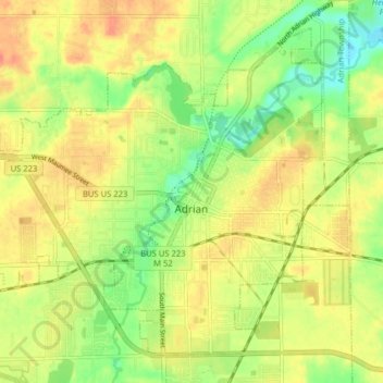
Name: Adrian topographic map, elevation, terrain.
Location: Adrian, Lenawee County, Michigan, 49221, United States (41.87488 -84.08918 41.92544 -84.00985)
Average elevation: 242 m
Minimum elevation: 217 m
Maximum elevation: 262 m
Other topographic maps
Click on a map to view its topography, its elevation and its terrain.
Tecumseh
United States > Michigan > Lenawee County
Tecumseh, Lenawee County, Michigan, 49286, United States
Average elevation: 247 m