
Orono topographic map
Interactive map
Click on the map to display elevation.
About this map
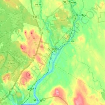
Name: Orono topographic map, elevation, terrain.
Location: Orono, Penobscot County, Maine, United States (44.84527 -68.80270 44.91291 -68.63752)
Average elevation: 44 m
Minimum elevation: -2 m
Maximum elevation: 113 m
Other topographic maps
Click on a map to view its topography, its elevation and its terrain.
Spring Island
United States > Maine > Penobscot County > T4 Indian Purchase Township
Average elevation: 151 m