
Leech Pond topographic map
Interactive map
Click on the map to display elevation.
About this map
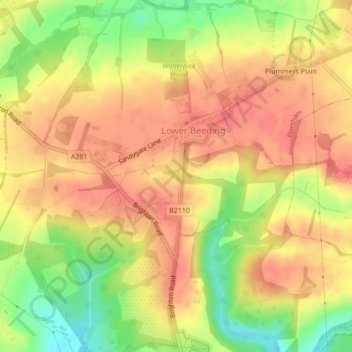
Name: Leech Pond topographic map, elevation, terrain.
Average elevation: 84 m
Minimum elevation: 44 m
Maximum elevation: 106 m
Other topographic maps
Click on a map to view its topography, its elevation and its terrain.
West Chiltington Common
United Kingdom > England > Horsham > West Chiltington Common
West Chiltington Common, Horsham, West Sussex, South East England, England, RH20 2LY, United Kingdom
Average elevation: 34 m