
Windermere topographic map
Interactive map
Click on the map to display elevation.
About this map
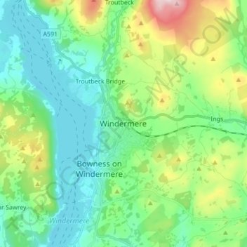
Name: Windermere topographic map, elevation, terrain.
Average elevation: 147 m
Minimum elevation: 35 m
Maximum elevation: 465 m
Other topographic maps
Click on a map to view its topography, its elevation and its terrain.
Garsdale
United Kingdom > England > Westmorland and Furness > Sedbergh
Garsdale, Sedbergh, Westmorland and Furness, England, United Kingdom
Average elevation: 361 m