
Holland River topographic map
Interactive map
Click on the map to display elevation.
About this map
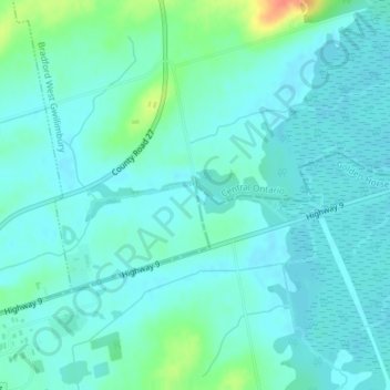
Name: Holland River topographic map, elevation, terrain.
Average elevation: 228 m
Minimum elevation: 218 m
Maximum elevation: 267 m
Other topographic maps
Click on a map to view its topography, its elevation and its terrain.
Bradford West Gwillimbury
Canada > Ontario > Bradford West Gwillimbury
Bradford West Gwillimbury, Simcoe County, Central Ontario, Ontario, L3Z 2A8, Canada
Average elevation: 259 m