
Bonne Terre topographic map
Interactive map
Click on the map to display elevation.
About this map
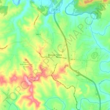
Name: Bonne Terre topographic map, elevation, terrain.
Location: Bonne Terre, St. Francois County, Missouri, 63628, USA (37.88477 -90.59106 37.96477 -90.51106)
Average elevation: 239 m
Minimum elevation: 188 m
Maximum elevation: 324 m