
Dunn Peak topographic map
Interactive map
Click on the map to display elevation.
About this map
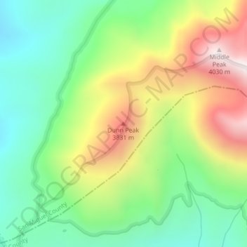
Name: Dunn Peak topographic map, elevation, terrain.
Location: Dunn Peak, San Miguel County, Colorado, United States (37.84744 -108.12568 37.84754 -108.12558)
Average elevation: 3,487 m
Minimum elevation: 3,141 m
Maximum elevation: 4,026 m
Other topographic maps
Click on a map to view its topography, its elevation and its terrain.
Telluride
United States > Colorado > San Miguel County
Telluride, San Miguel County, Colorado, 81435, United States
Average elevation: 3,125 m