
Fátima topographic map
Interactive map
Click on the map to display elevation.
About this map
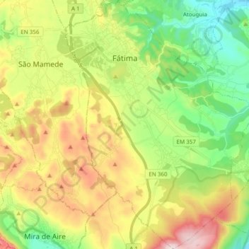
Name: Fátima topographic map, elevation, terrain.
Location: Fátima, Ourém, Santarém, Médio Tejo, Centro, Portugal (39.53582 -8.70225 39.65260 -8.58739)
Average elevation: 359 m
Minimum elevation: 139 m
Maximum elevation: 677 m