
Gardiner topographic map
Interactive map
Click on the map to display elevation.
About this map
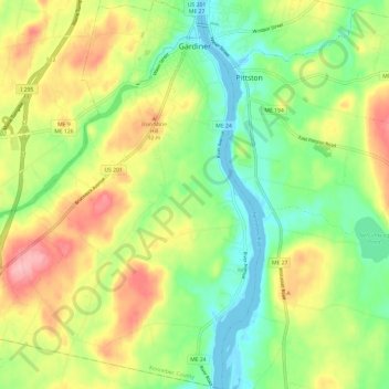
Name: Gardiner topographic map, elevation, terrain.
Location: Gardiner, Kennebec County, Maine, 04345, United States (44.15323 -69.85604 44.23873 -69.75221)
Average elevation: 52 m
Minimum elevation: -3 m
Maximum elevation: 123 m
Other topographic maps
Click on a map to view its topography, its elevation and its terrain.
Belgrade
United States > Maine > Kennebec County
Belgrade, Kennebec County, Maine, United States
Average elevation: 104 m
Augusta
United States > Maine > Kennebec County
Augusta, Kennebec County, Maine, 04330, United States
Average elevation: 75 m
Graveyard
United States > Maine > Kennebec County > Belgrade
Graveyard, Belgrade, Kennebec County, Maine, United States
Average elevation: 87 m
Midway Island
United States > Maine > Kennebec County > Belgrade
Midway Island, Belgrade, Kennebec County, Maine, United States
Average elevation: 107 m