
Perušić topographic map
Interactive map
Click on the map to display elevation.
About this map
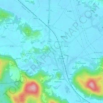
Name: Perušić topographic map, elevation, terrain.
Location: Perušić, Općina Perušić, Lika-Senj County, 53202, Croatia (44.62972 15.36300 44.66972 15.40300)
Average elevation: 599 m
Minimum elevation: 569 m
Maximum elevation: 771 m
Grabovača is a cave park situated between the Lika karstic plains and fields, 2 kilometres (1.2 mi) from the center of Perušić. It is 770 metres (2,530 ft) above sea level at the mid-elevations of the Velebit mountains, near the karst basin of the river Lika. In an area of 1.5 km2 (0.58 sq mi) there are an abundance of underground karst forms, complex calcite formations. The park represents one-quarter of the protected caves in Croatia. The caves are closed to the public in winter.