
Marmaris topographic map
Interactive map
Click on the map to display elevation.
About this map
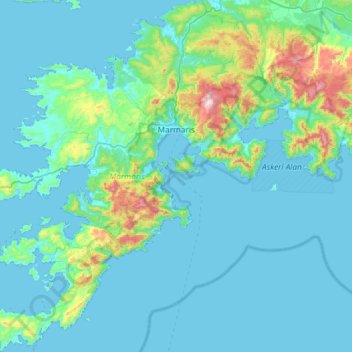
Name: Marmaris topographic map, elevation, terrain.
Location: Marmaris, Muğla, Aegean Region, Turkey (36.55356 27.95641 37.02509 28.42672)
Average elevation: 93 m
Minimum elevation: -1 m
Maximum elevation: 993 m
Other topographic maps
Click on a map to view its topography, its elevation and its terrain.