
Fayetteville topographic map
Interactive map
Click on the map to display elevation.
About this map
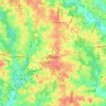
Name: Fayetteville topographic map, elevation, terrain.
Location: Fayetteville, Fayette County, Georgia, United States (33.41280 -84.52885 33.49112 -84.42163)
Average elevation: 265 m
Minimum elevation: 234 m
Maximum elevation: 295 m