
West New York topographic map
Interactive map
Click on the map to display elevation.
About this map
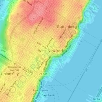
Name: West New York topographic map, elevation, terrain.
Location: West New York, Hudson County, New Jersey, United States (40.77455 -74.02361 40.79658 -73.99300)
Average elevation: 35 m
Minimum elevation: -2 m
Maximum elevation: 82 m
Other topographic maps
Click on a map to view its topography, its elevation and its terrain.