
Cocody topographic map
Interactive map
Click on the map to display elevation.
About this map
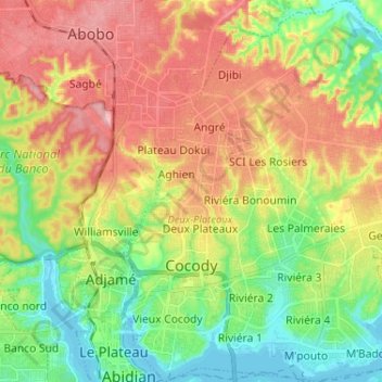
Name: Cocody topographic map, elevation, terrain.
Location: Cocody, Abidjan, Côte d'Ivoire (5.31786 -4.01781 5.44665 -3.91097)
Average elevation: 62 m
Minimum elevation: -4 m
Maximum elevation: 136 m