
南隘里 topographic map
Interactive map
Click on the map to display elevation.
About this map
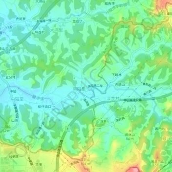
Name: 南隘里 topographic map, elevation, terrain.
Location: 南隘里, Nan'ai, Xiangshan District, Hsinchu, 30012, TW (24.71014 120.91673 24.75014 120.95673)
Average elevation: 37 m
Minimum elevation: 5 m
Maximum elevation: 114 m