
Osiedle Borek topographic map
Interactive map
Click on the map to display elevation.
About this map
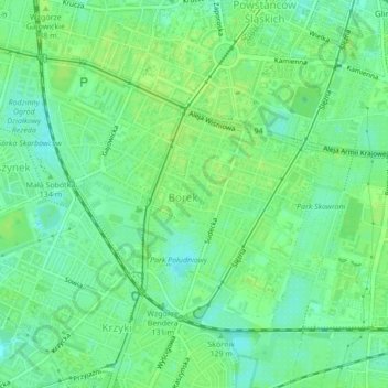
Name: Osiedle Borek topographic map, elevation, terrain.
Location: Osiedle Borek, Wrocław, Lower Silesian Voivodeship, Poland (51.07097 16.99591 51.08996 17.02668)
Average elevation: 125 m
Minimum elevation: 118 m
Maximum elevation: 130 m
Other topographic maps
Click on a map to view its topography, its elevation and its terrain.