
Yeoju-si topographic map
Interactive map
Click on the map to display elevation.
About this map
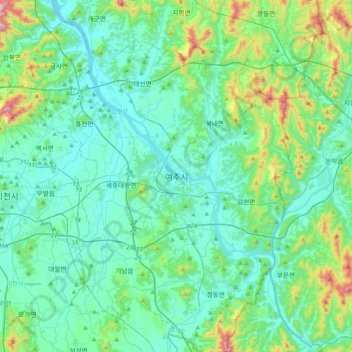
Name: Yeoju-si topographic map, elevation, terrain.
Location: Yeoju-si, Yangpyeong-gun, Gyeonggi-do, South Korea (37.13829 127.47703 37.45829 127.79703)
Average elevation: 129 m
Minimum elevation: 22 m
Maximum elevation: 629 m