
São Paulo topographic map
Interactive map
Click on the map to display elevation.
About this map
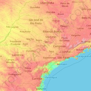
Name: São Paulo topographic map, elevation, terrain.
Location: São Paulo, Southeast Region, Brazil (-25.48327 -53.10900 -19.78233 -44.16100)
Average elevation: 554 m
Minimum elevation: 0 m
Maximum elevation: 2,555 m
Other topographic maps
Click on a map to view its topography, its elevation and its terrain.