
Nebraska City topographic map
Interactive map
Click on the map to display elevation.
About this map
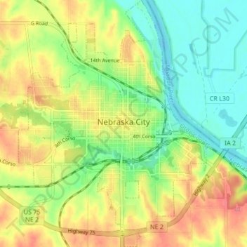
Name: Nebraska City topographic map, elevation, terrain.
Location: Nebraska City, Otoe County, Nebraska, United States (40.65050 -95.88762 40.70180 -95.83596)
Average elevation: 309 m
Minimum elevation: 275 m
Maximum elevation: 351 m
Other topographic maps
Click on a map to view its topography, its elevation and its terrain.
Old Fort Kearny Historical Marker
United States > Nebraska > Otoe County > Nebraska City
Old Fort Kearny Historical Marker, Nebraska City, Otoe County, Nebraska, 68412, United States
Average elevation: 299 m