
Errington topographic map
Interactive map
Click on the map to display elevation.
About this map
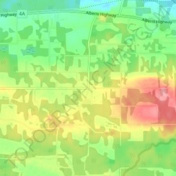
Name: Errington topographic map, elevation, terrain.
Average elevation: 120 m
Minimum elevation: 79 m
Maximum elevation: 173 m
Regional District of Nanaimo trails, hiking, mountain biking, running and outdoor activities
Other topographic maps
Click on a map to view its topography, its elevation and its terrain.
Englishman River Falls
Canada > British Columbia > Regional District of Nanaimo > Area F (Alberni Highway)
Average elevation: 198 m