Geolocate

Keizer topographic map

Click on the map to display elevation.

About this map

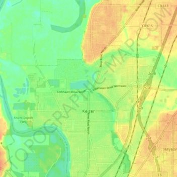
Name: Keizer topographic map, elevation, terrain.

Location: Keizer, Marion County, Oregon, 97303, United States (44.97296 -123.05712 45.03722 -122.99103)

Average elevation: 44 m

Minimum elevation: 25 m

Maximum elevation: 63 m

Gear up for your next adventure:

🧰Emergency Multi-Tool - Compact multi-tool for outdoor survival
🥾Trail Running Boots - Durable shoes designed for trail running
Lightweight Camping Tent - Portable shelter optimized for Canadian backcountry camping
🛏️Sleeping Bag - Warm and compact sleeping bags for outdoor camping
🛌Down Sleeping Bag - Superior warmth-to-weight ratio for cold nights

As an Amazon Associate, this site earns from qualifying purchases at no extra cost to you.