Geolocate

Levanger topographic map

Click on the map to display elevation.

About this map

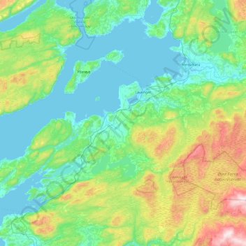
Name: Levanger topographic map, elevation, terrain.

Location: Levanger, Trøndelag, Norway (63.55122 10.79529 63.83599 11.72851)

Average elevation: 217 m

Minimum elevation: -1 m

Maximum elevation: 935 m

Gear up for your next adventure:

🥽Outdoor Goggles - Protective eyewear for outdoor activities
🚲Handlebar Phone Mount - View topographic-map.com live while cycling
🧼Travel Hand Sanitizer - Keep hands clean when water is scarce
🧴First Aid Kit - Essential first aid supplies for outdoor emergencies
🔦LED Flashlight - Powerful and long-lasting flashlight for camping and emergencies

As an Amazon Associate, this site earns from qualifying purchases at no extra cost to you.