
Thank you for supporting this site ❤️
Make a donation
Make a donation
Gear up for your next adventure:
As an Amazon Associate, this site earns from qualifying purchases at no extra cost to you.
Challapata topographic map
Click on the map to display elevation.
Thank you for supporting this site ❤️
Make a donation
Make a donation
Gear up for your next adventure:
As an Amazon Associate, this site earns from qualifying purchases at no extra cost to you.
About this map
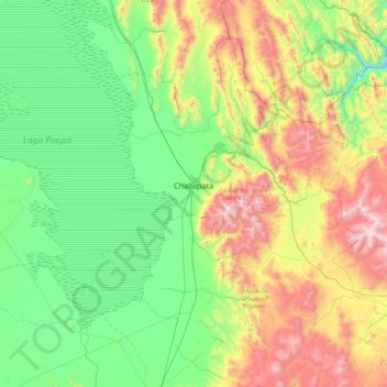
Name: Challapata topographic map, elevation, terrain.
Location: Challapata, Eduardo Abaroa, Oruro, Bolivia (-19.24696 -66.94185 -18.59015 -66.07758)
Average elevation: 3,968 m
Minimum elevation: 3,510 m
Maximum elevation: 5,108 m
Thank you for supporting this site ❤️
Make a donation
Make a donation
Gear up for your next adventure:
As an Amazon Associate, this site earns from qualifying purchases at no extra cost to you.