
Thank you for supporting this site ❤️
Make a donation
Make a donation
Gear up for your next adventure:
As an Amazon Associate, this site earns from qualifying purchases at no extra cost to you.
Tèmpiu/Tempio Pausania topographic map
Click on the map to display elevation.
Thank you for supporting this site ❤️
Make a donation
Make a donation
Gear up for your next adventure:
As an Amazon Associate, this site earns from qualifying purchases at no extra cost to you.
About this map
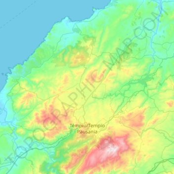
Name: Tèmpiu/Tempio Pausania topographic map, elevation, terrain.
Location: Tèmpiu/Tempio Pausania, Sassari, Sardinia, 07029, Italy (40.79864 8.98756 41.17265 9.31657)
Average elevation: 292 m
Minimum elevation: 0 m
Maximum elevation: 1,343 m
Thank you for supporting this site ❤️
Make a donation
Make a donation
Gear up for your next adventure:
As an Amazon Associate, this site earns from qualifying purchases at no extra cost to you.
Other topographic maps
Click on a map to view its topography, its elevation and its terrain.