
Caimalito topographic map
Click on the map to display elevation.
About this map
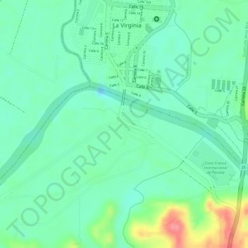
Name: Caimalito topographic map, elevation, terrain.
Average elevation: 902 m
Minimum elevation: 874 m
Maximum elevation: 963 m
Other topographic maps
Click on a map to view its topography, its elevation and its terrain.
Monserrate
Colombia > Risaralda > AMCO, Area Metropolitana Centro Occidente
Average elevation: 1,506 m
Villa Colombia
Colombia > Risaralda > AMCO, Area Metropolitana Centro Occidente
Average elevation: 1,405 m
Guadacanal
Colombia > Risaralda > AMCO, Area Metropolitana Centro Occidente
Average elevation: 1,319 m
Universidad
Colombia > Risaralda > AMCO, Area Metropolitana Centro Occidente
Average elevation: 1,430 m
Villa Cecilia
Colombia > Risaralda > AMCO, Area Metropolitana Centro Occidente
Average elevation: 1,307 m