Geolocate

Denver topographic map

Click on the map to display elevation.

About this map

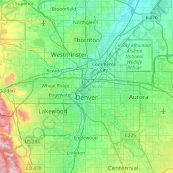
Name: Denver topographic map, elevation, terrain.

Location: Denver, Denver County, Colorado, United States (39.61432 -105.10988 39.91421 -104.59969)

Average elevation: 1,684 m

Minimum elevation: 1,515 m

Maximum elevation: 2,397 m

Gear up for your next adventure:

🌬️Windproof Camp Stove - Efficient cooking even on exposed mountain peaks
🧴Outdoor Sunscreen - High SPF protection for high-altitude UV exposure
🩹Moleskin Blister Pads - Direct protection for painful foot pressure points
🧰Multitool Knife - Compact and versatile tool for outdoor use
💡Solar Camping Lamp - Eco-friendly lighting for campsites

As an Amazon Associate, this site earns from qualifying purchases at no extra cost to you.