
Make a donation
Gear up for your next adventure:
As an Amazon Associate, this site earns from qualifying purchases at no extra cost to you.
Navi Mumbai topographic map
Click on the map to display elevation.
Make a donation
Gear up for your next adventure:
As an Amazon Associate, this site earns from qualifying purchases at no extra cost to you.
Navi Mumbai
Navi Mumbai (Marathi pronunciation: [nəʋiː mumbəiː]) is a planned city situated on the west coast of the Indian subcontinent, located in the Konkan division of Maharashtra state, on the mainland of India. Navi Mumbai is part of the Mumbai Metropolitan Region (MMR). The city is divided into two, North Navi Mumbai and South Navi Mumbai, for the individual development of Panvel Mega City, which includes the area from Kharghar to Uran, including the Taloja node. The Agri and Koli Communities mainly reside in Navi Mumbai. Navi Mumbai was the host city for the inaugural final of the IPL (2008) at DY Patil Stadium. Thane Belapur Marg and Palm Beach Marg are major business attraction and upmarket residential areas respectively. Navi Mumbai has a population of 1,119,477 as per the 2011 provisional census. It has an average city elevation of 14 meters, excluding forest area.
Make a donation
Gear up for your next adventure:
As an Amazon Associate, this site earns from qualifying purchases at no extra cost to you.
About this map
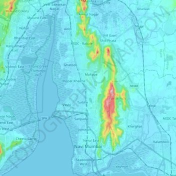
Name: Navi Mumbai topographic map, elevation, terrain.
Location: Navi Mumbai, Thane Subdistrict, Thane, Maharashtra, India (18.99845 72.97789 19.18947 73.04970)
Average elevation: 22 m
Minimum elevation: -3 m
Maximum elevation: 395 m
Make a donation
Gear up for your next adventure:
As an Amazon Associate, this site earns from qualifying purchases at no extra cost to you.