
Solingen topographic map
Click on the map to display elevation.
About this map
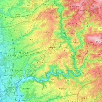
Name: Solingen topographic map, elevation, terrain.
Location: Solingen, North Rhine-Westphalia, Germany (51.11420 6.95110 51.22038 7.17408)
Average elevation: 184 m
Minimum elevation: 55 m
Maximum elevation: 371 m
Other topographic maps
Click on a map to view its topography, its elevation and its terrain.
Kierdorf
Germany > North Rhine-Westphalia > Rheinisch-Bergischer Kreis > Bergisch Gladbach > Herkenrath
Average elevation: 189 m