Geolocate

St. Charles topographic map

Click on the map to display elevation.

About this map
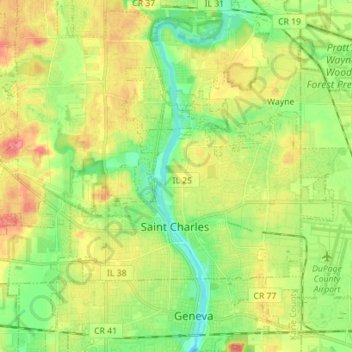
Name: St. Charles topographic map, elevation, terrain.

Location: St. Charles, St. Charles Township, Kane County, Illinois, 60174, United States (41.89702 -88.38960 41.96113 -88.24950)

Average elevation: 234 m

Minimum elevation: 204 m

Maximum elevation: 271 m

Other topographic maps

Click on a map to view its topography, its elevation and its terrain.
Elgin

United States > Illinois > Kane County

Average elevation: 255 m

Elgin

United States > Illinois > Kane County

Average elevation: 255 m

Campton Township

United States > Illinois > Kane County

Average elevation: 267 m

Gear up for your next adventure:

🦟Insect Repellent - Keep mosquitoes and black flies away in wooded areas
🥾Mountain Hiking Shoes - Shoes with superior grip for mountainous terrain
🥾Trail Running Shoes - Lightweight and durable shoes for trail running
💧Collapsible Water Bottle - Space-saving water bottle for outdoor activities
🪑Ultralight Camping Stool - Compact seating for rest stops during long hikes

As an Amazon Associate, this site earns from qualifying purchases at no extra cost to you.