
Thank you for supporting this site ❤️
Make a donation
Make a donation
Gear up for your next adventure:
As an Amazon Associate, this site earns from qualifying purchases at no extra cost to you.
Vélez-Rubio topographic map
Click on the map to display elevation.
Thank you for supporting this site ❤️
Make a donation
Make a donation
Gear up for your next adventure:
As an Amazon Associate, this site earns from qualifying purchases at no extra cost to you.
About this map
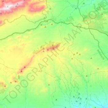
Name: Vélez-Rubio topographic map, elevation, terrain.
Location: Vélez-Rubio, Los Vélez, Almeria, Andalusia, 04820, Spain (37.47723 -2.20224 37.66921 -1.91115)
Average elevation: 944 m
Minimum elevation: 457 m
Maximum elevation: 2,041 m
Thank you for supporting this site ❤️
Make a donation
Make a donation
Gear up for your next adventure:
As an Amazon Associate, this site earns from qualifying purchases at no extra cost to you.
Other topographic maps
Click on a map to view its topography, its elevation and its terrain.