Geolocate

Bikna topographic map

Click on the map to display elevation.

About this map

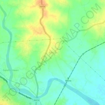
Name: Bikna topographic map, elevation, terrain.

Location: Bikna, Bankura - II, Bankura, West Bengal, 722180, India (23.23428 87.07068 23.27428 87.11068)

Average elevation: 85 m

Minimum elevation: 72 m

Maximum elevation: 104 m

Gear up for your next adventure:

🧢Outdoor Cap - Protective cap for sun and rain during hikes
🥾Waterproof Hiking Boots - Boots keeping your feet dry in wet conditions
🧤Thermal Hiking Gloves - Grip-enhanced gloves for cold-weather altitude trekking
Tent Footprint - Protect tent floor and increase durability
👖Convertible Hiking Pants - Zip-off legs to adapt to changing weather conditions

As an Amazon Associate, this site earns from qualifying purchases at no extra cost to you.