Geolocate

Seynod topographic map

Click on the map to display elevation.

About this map
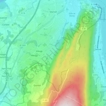
Name: Seynod topographic map, elevation, terrain.

Location: Seynod, Annecy, Upper Savoy, Auvergne-Rhône-Alpes, Metropolitan France, 74600, France (45.82800 6.04841 45.89548 6.11865)

Average elevation: 651 m

Minimum elevation: 416 m

Maximum elevation: 1,334 m

Other topographic maps

Click on a map to view its topography, its elevation and its terrain.
Gear up for your next adventure:

🌬️Windproof Camp Stove - Efficient cooking even on exposed mountain peaks
🥾Approach Boots - Comfortable boots for hiking and climbing approaches
💡Portable Camping Lamp - Rechargeable lamp for campsite lighting
🧢Outdoor Cap - Protective cap for sun and rain during hikes
🦶Hiking Shoe Insoles - Added support for high arches and long days on feet

As an Amazon Associate, this site earns from qualifying purchases at no extra cost to you.