Geolocate

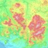
Teora topographic map

Click on the map to display elevation.

About this map
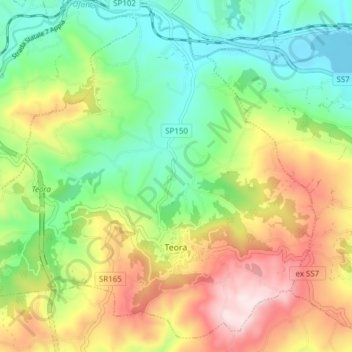
Name: Teora topographic map, elevation, terrain.

Location: Teora, Avellino, Campania, Italy (40.83765 15.20648 40.89112 15.28311)

Average elevation: 607 m

Minimum elevation: 428 m

Maximum elevation: 878 m

Other topographic maps

Click on a map to view its topography, its elevation and its terrain.

Pizzo d'Alvano

Italy > Campania > Avellino > Quindici

Average elevation: 763 m

Quaglietta

Italy > Campania > Avellino > Calabritto

Average elevation: 320 m

Santa Barbara

Italy > Campania > Avellino > Ariano Irpino

Average elevation: 461 m

Ariano Scalo

Italy > Campania > Avellino > Ariano Irpino

Average elevation: 576 m

Gear up for your next adventure:

🧊Portable Cooler - Keep food and drinks cold during outdoor adventures
🚲MTB Frame Bag - Carry tools and maps directly on your bicycle frame
🎒Fully Waterproof Backpack - Total protection for photography gear and electronics
🧴Outdoor Sunscreen - High SPF protection for high-altitude UV exposure
🕯️Camping Lantern - Illuminates your entire campsite with high-efficiency LEDs

As an Amazon Associate, this site earns from qualifying purchases at no extra cost to you.