
Noonan topographic map
Click on the map to display elevation.
About this map
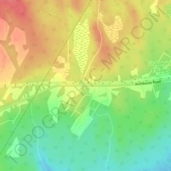
Name: Noonan topographic map, elevation, terrain.
Average elevation: 91 m
Minimum elevation: 57 m
Maximum elevation: 124 m
Capital Region Rural District trails, hiking, mountain biking, running and outdoor activities
Other topographic maps
Click on a map to view its topography, its elevation and its terrain.
Maugerville
Canada > New Brunswick > Capital Region Rural District > Maugerville Parish
Average elevation: 25 m