Geolocate

Tago topographic map

Click on the map to display elevation.

About this map

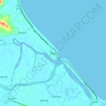
Name: Tago topographic map, elevation, terrain.

Location: Tago, Surigao del Sur, Caraga, Philippines (8.97950 126.19315 9.05950 126.27315)

Average elevation: 3 m

Minimum elevation: -4 m

Maximum elevation: 65 m

Gear up for your next adventure:

🥾Hiking Shoes - Durable and comfortable shoes for trail hiking
🧊Portable Cooler - Keep food and drinks cold during outdoor adventures
🥾Waterproof Hiking Shoes - Durable shoes for wet and rugged trails
💧Hydration Bladder - Hands-free hydration solution for long treks
🛁Quick-Dry Microfiber Towel - Space-saving towel that dries rapidly on the move

As an Amazon Associate, this site earns from qualifying purchases at no extra cost to you.