
Lachapelle-sous-Chanéac topographic map
Interactive map
Click on the map to display elevation.
About this map
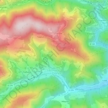
Name: Lachapelle-sous-Chanéac topographic map, elevation, terrain.
Average elevation: 775 m
Minimum elevation: 559 m
Maximum elevation: 1,046 m